- Report Number: 132
- Year: 2011
Development of a Geographic Information System for the Commonwealth Utility Corporation, Saipan Water Distribution System
The US Environmental Protection Agency (EPA) has recently stressed that the water distribution system in Saipan, Commonwealth of the Mariana Islands (CNMI) is still in need of improvement. The EPA has acknowledged that the lack of safe drinking water has been among the top environmental challenges that the EPA found to be facing the CNMI, particularly Saipan. In a previous assessment, the EPA found Saipan to be the only municipality of its size in the United States without 24-hour water delivery. The agency reported that the water on the island is not drinkable due to its high salinity, and water flows through the pipes only a few hours per day for almost half of the island’s residents.
In March of 2009, the CNMI, Commonwealth Utilities Corporation (CUC) entered into a stipulated order (STO) for preliminary relief under an agreement with the Government of the United States. The order provided for a long list of compliance items that CUC must complete in order to satisfy the stipulated order. One major item that CUC must prepare is a master plan for their water supply and wastewater systems. A part of this master plan is the “Development of a Geographic Information System (GIS) of the CUC drinking water and systems to facilitate better management of the CUC’s system”. As mentioned in the STO, the CUC will locate, map, and develop GIS layers for all of the following: treatment facilities, wells, water lines, storage tanks, collection systems, pump stations, and CUC’s and Department of Environmental Quality (DEQ’s) water quality monitoring stations.
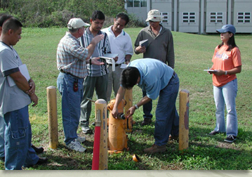
A healthy water system that can perform its essential functions requires a good record of system inventory, location, connectivity, and maintenance practices. This information should be easily available to the water managers and field operators. Prior to this study, the water and inventory and maintenance data were being entered manually and stored in file folders. This created excess paperwork and it made it very difficult to track the frequency of maintenance, hard to provide information to the field operator groups, and created a lack of close communication between system managers and field operators. Additionally, there was no link between the physical hydraulic model of the water system that was previously created by WERI and the maintenance and system inventories. What this study accomplished was to initiate the creation of a GIS that contains the system description and system maintenance schedules and that can be made readily available to system managers and field operators. This project concentrated on the drinking water side of the CUC operation. It is anticipated that in the future the data base will be extended to include the system and the data from water meters that are being installed. The benefit of this project will be to provide an improved and more efficient management and operation of the Saipan water system.
- Author(s):
- Leroy F. Heitz
- Shahram Khosrowpanah