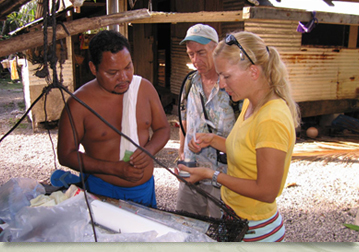
Three permanent palustrine wetlands in the Ugum Watershed with a combined drainage area of about 55 hectares and nearly 1,500 meters of combined riverine floodplain and contiguous forested and savanna slopes sections were studied. Goals were to identify and describe wetlands resources, functions, and values within a timeframe for field observations and measurements of about 7 months. The investigating team consisted of a geologist, a civil engineer, a toxicologist, a microbiologist, and two wildlife biologists, assisted by graduate and undergraduate students and other interested faculty from the University of Guam.
The biological survey confirmed earlier and more comprehensive efforts by Raulerson et al. (1978) concerning the diversity and distribution of terrestrial and aquatic plants and animals. The ravine forest enclosing the river sections and the downstream ends of the wetlands are fairly homogeneous, relatively pristine, and contain several interesting and rare communities of plants. It is clear that the value of these wetlands is high in regard to wildlife habitat.
Wetlands influence Ugum River stream flows and sedimentation in the dry season when sudden rains follow weeks of dry weather. Flow stages and stream and sediment discharges are modulated by the baffling effect of marsh grasses and tree hummocks and the absorbency of water in thick porous mats of decaying biomass. Wet season brings the wetlands' biomass and soils to a more water-saturated condition and hydrodynamic and sedimentologic functions are not as well demonstrated during those months. There is along unaddressed need to quantify the relationship between rainfall distribution, wetlands hydrology, downstream flows, and sediment discharge.
Many wetlands resources combine to control water chemistry through poorly understood biotic and abiotic reactions. Levels of trace metals and nutrients, in turn, affect the chemistry of the river into which the wetland empties. However, the immediate influence of a specific wetland is rapidly masked by dilution. One wetland in this study has phosphate levels well in excess of ten times that of other wetlands, yet its contribution to dissolved phosphate levels in the Ugum River is not obvious after a few tens of meters downstream from the confluence. River flow characteristics also affect local water chemistry as reaches of high turbulence and aeration alternate with more laminar flows, and occasionally with oxygen-depleted conditions in slackwater pools. These changes in dissolved oxygen can be seen in nutrient data.
The valley of the Ugum-Bubulao Rivers is aesthetically of great value to the people of Guam. But it also presents a unique opportunity for conducting far-reaching educational and research programs into tropical wetlands and rivers. While overview data in geology, biology, soils, hydrology, etc. abound and need not be reinvented, fundamental information on water quality controls is sorely lacking: mechanisms, buffering and forcing functions, fluxes, kinetics, reaction rates, and the spatial and temporal variation in those parameters is simply unknown. The need for a sustainable source of good quality water is a justifiable rationale for undertaking a more focused research effort in these wetlands in the future.